Scenarios & Maps
RealSim-CP covers three Tokyo environments, each captured under three weather/time conditions.
Maps
| Map | Environment | RSUs | Sensor-equipped vehicles |
|---|---|---|---|
| Aomi | Complex urban intersections | 2–4 | 1–23 |
| Odaiba / Daiba | Wide roads, multiple intersections | 4–8 | 1–11 |
| Shutoko Expressway | Expressway | 2–6 | 1–47 |
Each map is captured under clear daytime, rainy daytime, and clear nighttime conditions. The physics-based renderer reproduces the visual character of each condition — note the wet road reflections and reduced visibility at night below.
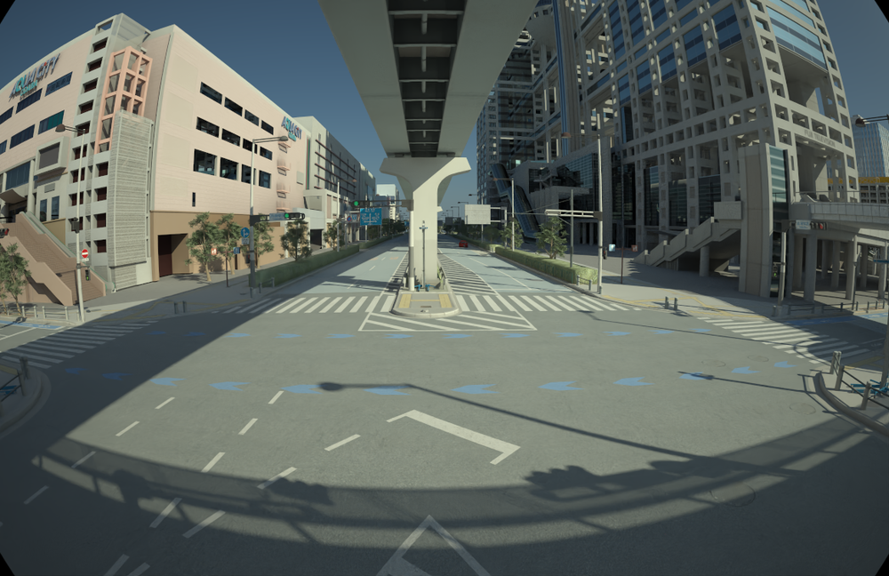 /// caption
Clear daytime (RSU camera)
///
/// caption
Clear daytime (RSU camera)
///
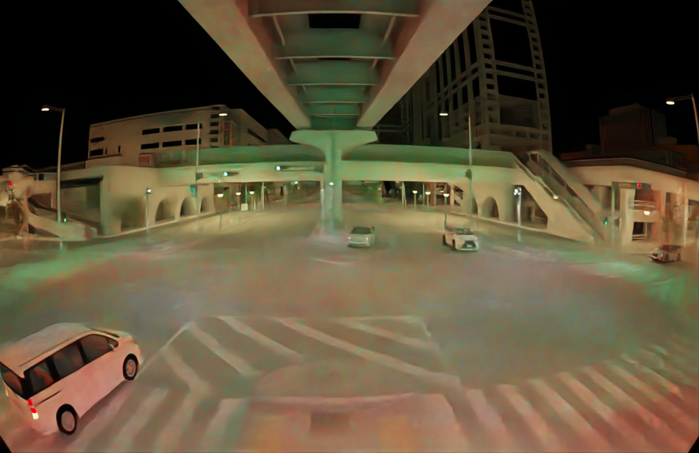 /// caption
Clear nighttime (RSU camera)
///
/// caption
Clear nighttime (RSU camera)
///
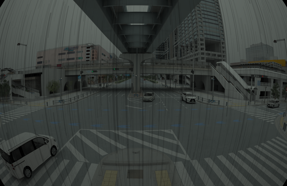 /// caption
Rainy daytime (RSU camera)
///
/// caption
Rainy daytime (RSU camera)
///
Scenario catalogue
| Scenario | Status | Variants |
|---|---|---|
| Daiba Station | Available (documented below) | sunny ×2, night ×2, rainy ×2 |
| Shutoko | Available | weather/time variants |
| Aomi Crossing | Planned | TBD |
The Daiba Station scenario is the worked example used throughout this documentation.
Daiba Station scenario
Modeled on the area around Daiba Station, Tokyo. Six variants across three weather/time conditions, each ~10 s at 10 Hz.
Variant summary
| Variant | Frames | Image agents | LiDAR agents | RSUs | Vehicles | Label size |
|---|---|---|---|---|---|---|
sunny_1 |
101 | 12 | 8 ⚠ | 3 | 9 | 2.71 MB |
sunny_2 |
100 | 12 | 0 ⚠ | 3 | 9 | 2.69 MB |
night_1 |
101 | 15 | 14 | 4 | 11 | 2.71 MB |
night_2 |
100 | 15 | 14 | 4 | 11 | 2.69 MB |
rainy_1 |
101 | 5 | 5 | 4 | 1 | 1.31 MB |
rainy_2 |
100 | 5 | 5 | 4 | 1 | 1.30 MB |
⚠ See Known issues for the sunny_1 / sunny_2 point-cloud
gaps.
Agent roster — night_1 (most complete variant)
| Agent | Role | Cameras | LiDAR |
|---|---|---|---|
rsu_1 … rsu_4 |
Road-side units (static) | one each (camera_1..4) |
one each (lidar_1..4) |
vehicle_10000 |
Connected vehicle | camera_9..12 |
lidar_5 |
vehicle_10010 |
Connected vehicle | camera_13..16 |
lidar_6 |
vehicle_10020 |
Connected vehicle | camera_17..20 |
lidar_7 |
vehicle_10030 |
Connected vehicle | camera_21..24 |
lidar_8 |
vehicle_10060 |
Connected vehicle | camera_25..28 |
lidar_9 |
vehicle_10070 |
Connected vehicle | camera_29..32 |
lidar_10 |
vehicle_10080 |
Connected vehicle | camera_33..36 |
lidar_11 |
vehicle_10090 |
Connected vehicle | camera_37..40 |
lidar_12 |
vehicle_10100 |
Connected vehicle | camera_41..44 |
lidar_13 |
vehicle_10190 |
Connected vehicle | camera_45..48 |
lidar_14 |
vehicle_10200 |
Connected vehicle | camera_49..52 |
lidar_15 |
Total for night_1: 52 camera streams + 14 LiDAR streams = 66 sensor
streams, organized across 86 coordinate systems (1 scene + 15 agent-local
+ ~70 sensor frames).
Annotation statistics — night_1
- 101 frames × 13 tracked objects per frame = 1,313 object instances.
- 13 unique object IDs persist for the whole clip.
| Class | Instances |
|---|---|
TYPE_MEDIUM_CAR |
505 |
TYPE_COMPACT_CAR |
303 |
TYPE_PEDESTRIAN |
202 |
TYPE_SMALL_CAR |
101 |
TYPE_BUS |
101 |
TYPE_LUXURY_CAR |
101 |
| Total | 1,313 |
Class imbalance
Across the full dataset, vehicle classes (especially cars) dominate — the Shutoko Expressway in particular is car-heavy. This imbalance is a known characteristic that affects rare-class detection; see Benchmark.